Screening of Potential Sites
Menu
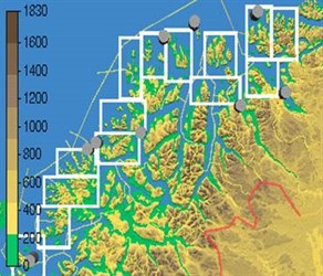
In 1998, WindSim AS established the Norwegian Wind Atlas in cooperation with the Norwegian Meteorological institute. Simulating the local wind field conditions along the complex Norwegian coastline was a challenging task.
The WindSim methodology was developed during this project to help meet those demands. It’s success led to the productization of WindSim as a powerful CFD software solution today has a leading position in the wind industry.
After the wind resource map is generated, buildable wind areas are identified and ranked. The buildable windy area is often constrained by topography and also by other factors. WindSim will consider the following:
- Proximity to the transmission lines
- Land use restriction
- Cultural, environmental, and other concerns
- Proximity to residential areas
- Road access
- Land use