TØNSBERG, NORWAY (December 12, 2017) - Vaisala, a global leader in environmental and industrial measurement,
has collaborated with WindSim, a pioneer in computational fluid dynamics (CFD) modelling, on a study that demonstrates how
the effects of complex terrain on wind measurements collected by remote sensing units can be mitigated. The collaboration has
included the most extensive complex terrain validation of remote sensing data undertaken in the wind energy sector to date.
The results establish a methodology for considerably reducing the uncertainty of data collected by the Triton Wind Profiler in
complex terrain, opening the door to more effective measurement campaigns in areas of untapped resource
For wind energy developers prospecting at more challenging, off-grid sites - such as on ridge lines, hillsides and in heavily
forested areas - the versatility, maneuverability and size of remote sensing devices means that they offer numerous potential
advantages over met towers. Validating the accuracy of a remote sensing system in complex terrain removes one of the few remaining
barriers to the widespread adoption of the technology across the industry.
"While remote sensing devices are increasingly supplanting met towers as the preferred technology for wind measurement campaigns,
concerns over the way both SoDAR and LiDAR technologies respond to complex air flows have posed an obstacle," said Pascal Storck,
Director of Renewable Energy at Vaisala. "Our study with WindSim shows how topographical factors can reliably be accounted for."
An unprecedented global collocation study
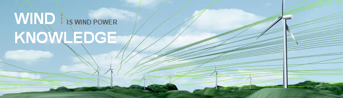
Independent R&D efforts continue to set the standard for wind measurement practices worldwide. Increasingly, advanced CFD
methodologies are being used by respected companies such as WindSim to evaluate how remote sensing units respond to wind flow
in complex terrain, in order to determine where corrections to wind estimates can be made. This is not required in areas where
the ground is relatively flat and the flow field is uniform, but in complex terrain, this flow field can be disrupted,
introducing a bias into the measured wind speeds.
Vaisala's extensive complex terrain validation study spanned 20 individual sites, each with a collocated Triton Wind Profiler
and met mast, collecting simultaneous measurements for a period of 1-4 months. These sites were distributed across the globe
and exhibited a variety of local terrain complexity.
Using publicly available elevation and land cover data, WindSim configured CFD simulation domains surrounding each collocation
site and conducted simulations for a variety of inflow conditions. From these simulations, Vaisala developed correction factors
to account for wind flow curvature, for each measurement height and wind direction sector.
By applying these CFD-based corrections to Triton data, Vaisala found a reduction in the mean wind speed difference between
the Tritons and met towers - from -1.7% to -0.1% - and in the standard deviation - from 2.5% to 2.1%. The correction therefore
not only eliminated the overall bias, but also reduced the spread of error among the sites.
A reliable, repeatable methodology
"The accuracy of remote sensing data has widely been recognized as on a par with that of met towers in all aspects - except
when it comes to operating in complex terrain," said Dr. Arne Gravdahl, WindSim Founder and Chief Technical Officer. "Using
CFD simulations to adjust Triton data removes this concern, levelling the playing field in terms of data quality, and allowing
developers to take full advantage of the Triton's versatility."
"Our study shows that it's a reliable, repeatable methodology, and we're looking forward to seeing the impact it has for Vaisala's
clients as they pioneer wind development in those parts of the world where the best resource isn't always on flat terrain."
The issue of complex terrain and the validation of wind measurement data is further discussed in Vaisala's
Remote Sensing Revolution report, which brings together perspectives from across the wind energy sector,
encompassing developers, operators, financiers and consultants. If you would like to download a copy of the report,
please
click here.
Vaisala Energy
Weather provides the fuel for renewable energy projects and is one of the largest variables impacting production.
Vaisala uses more than 80 years of weather expertise to help the global renewable energy industry develop and operate
wind and solar projects better, faster and more efficiently. Our measurement, assessment, forecasting and asset management
products and services leverage proven science and advanced technology to mitigate the impact of weather risks on energy
generation and support profitable decision-making across the entire project lifecyle, from greenfield prospecting and due
diligence through operational forecasting and plant optimization.
www.vaisala.com/energy
twitter.com/VaisalaEnergy
linkedin.com/company/vaisala-energy
About Vaisala
Vaisala is a global leader in environmental and industrial measurement. Building on 80 years of experience, Vaisala provides
observations for a better world. We are a reliable partner for customers around the world, offering a comprehensive range of
innovative observation and measurement products and services. Headquartered in Finland, Vaisala employs approximately 1,600
professionals worldwide and is listed on the Nasdaq Helsinki stock exchange.
www.vaisala.com
www.twitter.com/VaisalaGroup
About WindSim
WindSim develops and delivers advanced software solutions and consulting services that help worldwide wind energy industry
leaders design more profitable wind farms. WindSim, the company's flagship product, is a world-class software solution based
on CFD that combines advanced numeric processing with compelling 3D visualization in a user-friendly interface. Founded in 1993,
WindSim is privately-held and venture-backed.
www.windsim.com
MEDIA CONTACT